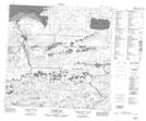
Maps showing Chatelain Lake, Saskatchewan
Chatelain Lake is a Lake located in Saskatchewan and has an elevation of 313 meters.
- Latitude: 59° 5' North (decimal: 59.0836784)
- Longitude: 107° 50' West (decimal: -107.8343580)
- Topography Feature Category: Lake
- Geographical Feature: Lake
- Canadian Province/Territory: Saskatchewan
- Elevation: 313 meters
- Atlas of Canada Locator Map: Chatelain Lake
- GPS Coordinate Locator Map: Chatelain Lake Lat/Long
Chatelain Lake NTS Map Sheets