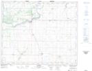
Maps showing Lac Chicot, 45A-28-W2, Saskatchewan
Lac Chicot is a Lake located in 45A-28-W2, Saskatchewan and has an elevation of 474 meters.
- Latitude: 52° 51' North (decimal: 52.8500376)
- Longitude: 105° 56' West (decimal: -105.9338774)
- Topography Feature Category: Lake
- Geographical Feature: Lac
- Canadian Province/Territory: Saskatchewan
- Elevation: 474 meters
- Location: 45A-28-W2
- Atlas of Canada Locator Map: Lac Chicot
- GPS Coordinate Locator Map: Lac Chicot Lat/Long