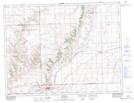
Maps showing Jones Point, Saskatchewan
Jones Point is a Mountain located in Saskatchewan.
- Latitude: 49° 30' North (decimal: 49.5000214)
- Longitude: 108° 57' West (decimal: -108.9507236)
- Topography Feature Category: Mountain
- Geographical Feature: Hill
- Canadian Province/Territory: Saskatchewan
- GPS Coordinate Locator Map: Jones Point Lat/Long
Jones Point NTS Map Sheets