Canada Topographic Maps

Avonlea Creek Topo Maps

Topography maps and Latitude/Longitude Location

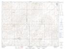
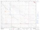
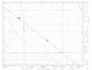
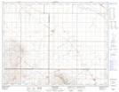
Maps showing Avonlea Creek, 4-14-22-W2, Saskatchewan

Avonlea Creek is a River located in 4-14-22-W2, Saskatchewan and has an elevation of 599 meters.

  • Latitude: 50° 9' North   (decimal: 50.1500364)
  • Longitude: 104° 57' West   (decimal: -104.9505565)
  • Topography Feature Category: River
  • Geographical Feature: Creek
  • Canadian Province/Territory: Saskatchewan
  • Elevation: 599 meters
  • Location: 4-14-22-W2
  • Atlas of Canada Locator Map: Avonlea Creek
  • GPS Coordinate Locator Map: Avonlea Creek Lat/Long

Avonlea Creek NTS Map Sheets

072H14 Spring Valley Topographic Map at 1:50,000 scale

072H15 Dummer Topographic Map at 1:50,000 scale

072I02 Rouleau Topographic Map at 1:50,000 scale

072I03 Briercrest Topographic Map at 1:50,000 scale

072H Willow Bunch Lake Topographic Map at 1:250,000 scale

072I Regina Topographic Map at 1:250,000 scale

 
Buy Topographic Maps DVD
Newsletter Sign-up

Yes, I want to receive map store discounts.


Bookmark and Share