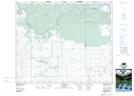
Maps showing Bagley, 12-47-19-W2, Saskatchewan
Bagley is a Unincorporated area located in 12-47-19-W2, Saskatchewan and has an elevation of 426 meters.
- Latitude: 53° 3' North (decimal: 53.0500154)
- Longitude: 104° 39' West (decimal: -104.6504821)
- Topography Feature Category: Unincorporated area
- Geographical Feature: Locality
- Canadian Province/Territory: Saskatchewan
- Elevation: 426 meters
- Location: 12-47-19-W2
- GPS Coordinate Locator Map: Bagley Lat/Long
Bagley NTS Map Sheets