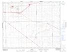
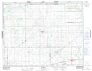
Maps showing Balgonie, 3-18-17-W2, Saskatchewan
Balgonie is a Town located in 3-18-17-W2, Saskatchewan and has an elevation of 667 meters.
- Latitude: 50° 29' 29'' North (decimal: 50.4914583)
- Longitude: 104° 15' 46'' West (decimal: -104.2629110)
- Topography Feature Category: Town
- Geographical Feature: Town
- Canadian Province/Territory: Saskatchewan
- Elevation: 667 meters
- Location: 3-18-17-W2
- Atlas of Canada Locator Map: Balgonie
- GPS Coordinate Locator Map: Balgonie Lat/Long
Balgonie NTS Map Sheets