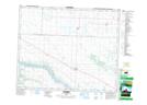
Maps showing Baljennie, 24-41-14-W3, Saskatchewan
Baljennie is a Unincorporated area located in 24-41-14-W3, Saskatchewan and has an elevation of 496 meters.
- Latitude: 52° 33' North (decimal: 52.5500593)
- Longitude: 107° 54' West (decimal: -107.9006560)
- Topography Feature Category: Unincorporated area
- Geographical Feature: Hamlet
- Canadian Province/Territory: Saskatchewan
- Elevation: 496 meters
- Location: 24-41-14-W3
- Atlas of Canada Locator Map: Baljennie
- GPS Coordinate Locator Map: Baljennie Lat/Long