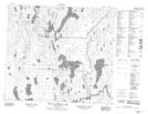
Maps showing Gale Rapids, Saskatchewan
Gale Rapids is a Rapids located in Saskatchewan and has an elevation of 431 meters.
- Latitude: 56° 14' North (decimal: 56.2334264)
- Longitude: 107° 32' West (decimal: -107.5340028)
- Topography Feature Category: Rapids
- Geographical Feature: Rapids
- Canadian Province/Territory: Saskatchewan
- Elevation: 431 meters
- Atlas of Canada Locator Map: Gale Rapids
- GPS Coordinate Locator Map: Gale Rapids Lat/Long
Gale Rapids NTS Map Sheets