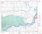
Maps showing Garrick, 17-52-16-W2, Saskatchewan
Garrick is a Hamlet located in 17-52-16-W2, Saskatchewan and has an elevation of 428 meters.
- Latitude: 53° 29' 34'' North (decimal: 53.4926389)
- Longitude: 104° 20' 19'' West (decimal: -104.3384778)
- Topography Feature Category: Hamlet
- Geographical Feature: Organized Hamlet
- Canadian Province/Territory: Saskatchewan
- Elevation: 428 meters
- Location: 17-52-16-W2
- Atlas of Canada Locator Map: Garrick
- GPS Coordinate Locator Map: Garrick Lat/Long
Garrick NTS Map Sheets