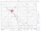
Maps showing Garwood, 1-8-14-W2, Saskatchewan
Garwood is a Unincorporated area located in 1-8-14-W2, Saskatchewan.
- Latitude: 49° 37' North (decimal: 49.6166909)
- Longitude: 103° 47' West (decimal: -103.7838730)
- Topography Feature Category: Unincorporated area
- Geographical Feature: Railway Point
- Canadian Province/Territory: Saskatchewan
- Location: 1-8-14-W2
- Atlas of Canada Locator Map: Garwood
- GPS Coordinate Locator Map: Garwood Lat/Long