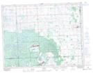
Maps showing Christopher Bay, Saskatchewan
Christopher Bay is a Bay located in Saskatchewan and has an elevation of 759 meters.
- Latitude: 49° 49' North (decimal: 49.8166789)
- Longitude: 102° 20' West (decimal: -102.3338279)
- Topography Feature Category: Bay
- Geographical Feature: Bay
- Canadian Province/Territory: Saskatchewan
- Elevation: 759 meters
- Atlas of Canada Locator Map: Christopher Bay
- GPS Coordinate Locator Map: Christopher Bay Lat/Long