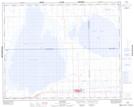
Maps showing Clair Lake, 10-35-15-W2, Saskatchewan
Clair Lake is a Lake located in 10-35-15-W2, Saskatchewan and has an elevation of 526 meters.
- Latitude: 51° 59' North (decimal: 51.9833370)
- Longitude: 104° 4' West (decimal: -104.0671871)
- Topography Feature Category: Lake
- Geographical Feature: Lake
- Canadian Province/Territory: Saskatchewan
- Elevation: 526 meters
- Location: 10-35-15-W2
- Atlas of Canada Locator Map: Clair Lake
- GPS Coordinate Locator Map: Clair Lake Lat/Long