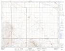
Maps showing Claybank, 33-12-24-W2, Saskatchewan
Claybank is a Hamlet located in 33-12-24-W2, Saskatchewan and has an elevation of 638 meters.
- Latitude: 50° 2' 41'' North (decimal: 50.0447250)
- Longitude: 105° 14' 1'' West (decimal: -105.2336463)
- Topography Feature Category: Hamlet
- Geographical Feature: Organized Hamlet
- Canadian Province/Territory: Saskatchewan
- Elevation: 638 meters
- Location: 33-12-24-W2
- Atlas of Canada Locator Map: Claybank
- GPS Coordinate Locator Map: Claybank Lat/Long