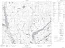
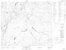
Maps showing Cobb Creek, 63-20-W2, Saskatchewan
Cobb Creek is a River located in 63-20-W2, Saskatchewan and has an elevation of 499 meters.
- Latitude: 54° 28' North (decimal: 54.4667235)
- Longitude: 104° 58' West (decimal: -104.9671120)
- Topography Feature Category: River
- Geographical Feature: Creek
- Canadian Province/Territory: Saskatchewan
- Elevation: 499 meters
- Location: 63-20-W2
- Atlas of Canada Locator Map: Cobb Creek
- GPS Coordinate Locator Map: Cobb Creek Lat/Long
Cobb Creek NTS Map Sheets