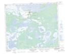
Maps showing Junction Creek, 56,57-3-W2, Saskatchewan
Junction Creek is a River located in 56,57-3-W2, Saskatchewan and has an elevation of 261 meters.
- Latitude: 53° 56' North (decimal: 53.9333798)
- Longitude: 102° 26' West (decimal: -102.4337800)
- Topography Feature Category: River
- Geographical Feature: Creek
- Canadian Province/Territory: Saskatchewan
- Elevation: 261 meters
- Location: 56,57-3-W2
- Atlas of Canada Locator Map: Junction Creek
- GPS Coordinate Locator Map: Junction Creek Lat/Long
Junction Creek NTS Map Sheets