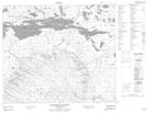
Maps showing Kain Lake, 68-14-W2, Saskatchewan
Kain Lake is a Lake located in 68-14-W2, Saskatchewan and has an elevation of 386 meters.
- Latitude: 54° 53' North (decimal: 54.8834010)
- Longitude: 104° 5' West (decimal: -104.0837470)
- Topography Feature Category: Lake
- Geographical Feature: Lake
- Canadian Province/Territory: Saskatchewan
- Elevation: 386 meters
- Location: 68-14-W2
- Atlas of Canada Locator Map: Kain Lake
- GPS Coordinate Locator Map: Kain Lake Lat/Long
Kain Lake NTS Map Sheets