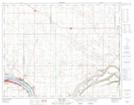
Maps showing Kannata Valley, 18-21-21-W2, Saskatchewan
Kannata Valley is a Village located in 18-21-21-W2, Saskatchewan and has an elevation of 516 meters.
- Latitude: 50° 47' 3'' North (decimal: 50.7842063)
- Longitude: 104° 54' 11'' West (decimal: -104.9030833)
- Topography Feature Category: Village
- Geographical Feature: Resort Village
- Canadian Province/Territory: Saskatchewan
- Elevation: 516 meters
- Location: 18-21-21-W2
- Atlas of Canada Locator Map: Kannata Valley
- GPS Coordinate Locator Map: Kannata Valley Lat/Long