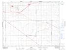
Maps showing Kathrintal Colony, 14-16-17-W2, Saskatchewan
Kathrintal Colony is a Unincorporated area located in 14-16-17-W2, Saskatchewan and has an elevation of 605 meters.
- Latitude: 50° 21' North (decimal: 50.3500374)
- Longitude: 104° 14' West (decimal: -104.2338745)
- Topography Feature Category: Unincorporated area
- Geographical Feature: Locality
- Canadian Province/Territory: Saskatchewan
- Elevation: 605 meters
- Location: 14-16-17-W2
- Atlas of Canada Locator Map: Kathrintal Colony
- GPS Coordinate Locator Map: Kathrintal Colony Lat/Long