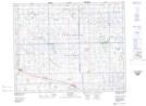
Maps showing Kelliher, 34-26-13-W2, Saskatchewan
Kelliher is a Village located in 34-26-13-W2, Saskatchewan and has an elevation of 672 meters.
- Latitude: 51° 15' 47'' North (decimal: 51.2629277)
- Longitude: 103° 44' 25'' West (decimal: -103.7401638)
- Topography Feature Category: Village
- Geographical Feature: Village
- Canadian Province/Territory: Saskatchewan
- Elevation: 672 meters
- Location: 34-26-13-W2
- Atlas of Canada Locator Map: Kelliher
- GPS Coordinate Locator Map: Kelliher Lat/Long