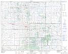
Maps showing Kelly Lake, 26,27-28-17-W2, Saskatchewan
Kelly Lake is a Lake located in 26,27-28-17-W2, Saskatchewan and has an elevation of 638 meters.
- Latitude: 51° 25' North (decimal: 51.4166999)
- Longitude: 104° 18' West (decimal: -104.3005447)
- Topography Feature Category: Lake
- Geographical Feature: Lake
- Canadian Province/Territory: Saskatchewan
- Elevation: 638 meters
- Location: 26,27-28-17-W2
- Atlas of Canada Locator Map: Kelly Lake
- GPS Coordinate Locator Map: Kelly Lake Lat/Long