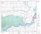
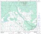
Maps showing Kelsey Creek, 29-51-16-W2, Saskatchewan
Kelsey Creek is a River located in 29-51-16-W2, Saskatchewan and has an elevation of 426 meters.
- Latitude: 53° 25' North (decimal: 53.4167115)
- Longitude: 104° 18' West (decimal: -104.3004642)
- Topography Feature Category: River
- Geographical Feature: Creek
- Canadian Province/Territory: Saskatchewan
- Elevation: 426 meters
- Location: 29-51-16-W2
- Atlas of Canada Locator Map: Kelsey Creek
- GPS Coordinate Locator Map: Kelsey Creek Lat/Long
Kelsey Creek NTS Map Sheets