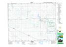
Maps showing Kendal, 17-15-12-W2, Saskatchewan
Kendal is a Village located in 17-15-12-W2, Saskatchewan and has an elevation of 654 meters.
- Latitude: 50° 15' 18'' North (decimal: 50.2548805)
- Longitude: 103° 36' 57'' West (decimal: -103.6158888)
- Topography Feature Category: Village
- Geographical Feature: Village
- Canadian Province/Territory: Saskatchewan
- Elevation: 654 meters
- Location: 17-15-12-W2
- Atlas of Canada Locator Map: Kendal
- GPS Coordinate Locator Map: Kendal Lat/Long