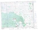
Maps showing Kenosee Park, 24-10-3-W2, Saskatchewan
Kenosee Park is a Unincorporated area located in 24-10-3-W2, Saskatchewan and has an elevation of 761 meters.
- Latitude: 49° 50' North (decimal: 49.8333474)
- Longitude: 102° 18' West (decimal: -102.3004941)
- Topography Feature Category: Unincorporated area
- Geographical Feature: Hamlet
- Canadian Province/Territory: Saskatchewan
- Elevation: 761 meters
- Location: 24-10-3-W2
- Atlas of Canada Locator Map: Kenosee Park
- GPS Coordinate Locator Map: Kenosee Park Lat/Long