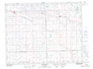
Maps showing Glenavon, 26-14-9-W2, Saskatchewan
Glenavon is a Village located in 26-14-9-W2, Saskatchewan and has an elevation of 675 meters.
- Latitude: 50° 11' 35'' North (decimal: 50.1930166)
- Longitude: 103° 8' 19'' West (decimal: -103.1386472)
- Topography Feature Category: Village
- Geographical Feature: Village
- Canadian Province/Territory: Saskatchewan
- Elevation: 675 meters
- Location: 26-14-9-W2
- Atlas of Canada Locator Map: Glenavon
- GPS Coordinate Locator Map: Glenavon Lat/Long
Glenavon NTS Map Sheets