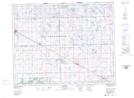
Maps showing Goodeve, 10-24-9-W2, Saskatchewan
Goodeve is a Village located in 10-24-9-W2, Saskatchewan and has an elevation of 639 meters.
- Latitude: 51° 3' 47'' North (decimal: 51.0630639)
- Longitude: 103° 11' 18'' West (decimal: -103.1884666)
- Topography Feature Category: Village
- Geographical Feature: Village
- Canadian Province/Territory: Saskatchewan
- Elevation: 639 meters
- Location: 10-24-9-W2
- Atlas of Canada Locator Map: Goodeve
- GPS Coordinate Locator Map: Goodeve Lat/Long