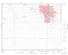
Maps showing Goose Island, 17-17-19-W2, Saskatchewan
Goose Island is a Island located in 17-17-19-W2, Saskatchewan and has an elevation of 560 meters.
- Latitude: 50° 26' North (decimal: 50.4333731)
- Longitude: 104° 35' West (decimal: -104.5838811)
- Topography Feature Category: Island
- Geographical Feature: Island
- Canadian Province/Territory: Saskatchewan
- Elevation: 560 meters
- Location: 17-17-19-W2
- Atlas of Canada Locator Map: Goose Island
- GPS Coordinate Locator Map: Goose Island Lat/Long