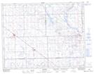
Maps showing Gooseberry Lake, 11,12-9-W2, Saskatchewan
Gooseberry Lake is a Lake located in 11,12-9-W2, Saskatchewan and has an elevation of 634 meters.
- Latitude: 49° 57' North (decimal: 49.9500184)
- Longitude: 103° 12' West (decimal: -103.2005198)
- Topography Feature Category: Lake
- Geographical Feature: Lake
- Canadian Province/Territory: Saskatchewan
- Elevation: 634 meters
- Location: 11,12-9-W2
- Atlas of Canada Locator Map: Gooseberry Lake
- GPS Coordinate Locator Map: Gooseberry Lake Lat/Long