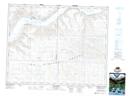
Maps showing Gouldtown, 17-19-9-W3, Saskatchewan
Gouldtown is a Unincorporated area located in 17-19-9-W3, Saskatchewan and has an elevation of 762 meters.
- Latitude: 50° 37' North (decimal: 50.6166998)
- Longitude: 107° 13' West (decimal: -107.2173150)
- Topography Feature Category: Unincorporated area
- Geographical Feature: Hamlet
- Canadian Province/Territory: Saskatchewan
- Elevation: 762 meters
- Location: 17-19-9-W3
- Atlas of Canada Locator Map: Gouldtown
- GPS Coordinate Locator Map: Gouldtown Lat/Long
Gouldtown NTS Map Sheets