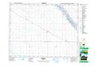
Maps showing Grayburn, 19-18-28-W2, Saskatchewan
Grayburn is a Unincorporated area located in 19-18-28-W2, Saskatchewan and has an elevation of 595 meters.
- Latitude: 50° 32' North (decimal: 50.5333650)
- Longitude: 105° 50' West (decimal: -105.8339193)
- Topography Feature Category: Unincorporated area
- Geographical Feature: Railway Point
- Canadian Province/Territory: Saskatchewan
- Elevation: 595 meters
- Location: 19-18-28-W2
- Atlas of Canada Locator Map: Grayburn
- GPS Coordinate Locator Map: Grayburn Lat/Long