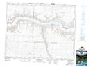
Maps showing Gray Lookout, 27-19-13-W3, Saskatchewan
Gray Lookout is a Mountain located in 27-19-13-W3, Saskatchewan and has an elevation of 634 meters.
- Latitude: 50° 38' North (decimal: 50.6333709)
- Longitude: 107° 44' West (decimal: -107.7340044)
- Topography Feature Category: Mountain
- Geographical Feature: Lookout
- Canadian Province/Territory: Saskatchewan
- Elevation: 634 meters
- Location: 27-19-13-W3
- Atlas of Canada Locator Map: Gray Lookout
- GPS Coordinate Locator Map: Gray Lookout Lat/Long
Gray Lookout NTS Map Sheets