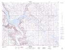
Maps showing Greasewood Coulee, 2-22,23-W2, Saskatchewan
Greasewood Coulee is a Valley located in 2-22,23-W2, Saskatchewan and has an elevation of 718 meters.
- Latitude: 49° 8' North (decimal: 49.1333626)
- Longitude: 104° 57' West (decimal: -104.9505332)
- Topography Feature Category: Valley
- Geographical Feature: Coulee
- Canadian Province/Territory: Saskatchewan
- Elevation: 718 meters
- Location: 2-22,23-W2
- Atlas of Canada Locator Map: Greasewood Coulee
- GPS Coordinate Locator Map: Greasewood Coulee Lat/Long
Greasewood Coulee NTS Map Sheets