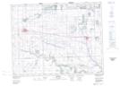
Maps showing Grenfell, 8-17-7-W2, Saskatchewan
Grenfell is a Town located in 8-17-7-W2, Saskatchewan and has an elevation of 597 meters.
- Latitude: 50° 24' 38'' North (decimal: 50.4106694)
- Longitude: 102° 55' 56'' West (decimal: -102.9322194)
- Topography Feature Category: Town
- Geographical Feature: Town
- Canadian Province/Territory: Saskatchewan
- Elevation: 597 meters
- Location: 8-17-7-W2
- Atlas of Canada Locator Map: Grenfell
- GPS Coordinate Locator Map: Grenfell Lat/Long