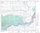
Maps showing Codette, 6-50-14-W2, Saskatchewan
Codette is a Village located in 6-50-14-W2, Saskatchewan and has an elevation of 369 meters.
- Latitude: 53° 16' 55'' North (decimal: 53.2818610)
- Longitude: 104° 1' 49'' West (decimal: -104.0301638)
- Topography Feature Category: Village
- Geographical Feature: Village
- Canadian Province/Territory: Saskatchewan
- Elevation: 369 meters
- Location: 6-50-14-W2
- Atlas of Canada Locator Map: Codette
- GPS Coordinate Locator Map: Codette Lat/Long
Codette NTS Map Sheets