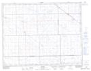
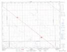
Maps showing Colfax Creek, 6-12-15-W2, Saskatchewan
Colfax Creek is a River located in 6-12-15-W2, Saskatchewan and has an elevation of 591 meters.
- Latitude: 49° 58' North (decimal: 49.9666968)
- Longitude: 104° 3' West (decimal: -104.0505528)
- Topography Feature Category: River
- Geographical Feature: Creek
- Canadian Province/Territory: Saskatchewan
- Elevation: 591 meters
- Location: 6-12-15-W2
- Atlas of Canada Locator Map: Colfax Creek
- GPS Coordinate Locator Map: Colfax Creek Lat/Long
Colfax Creek NTS Map Sheets