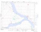
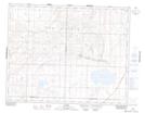
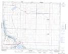
Maps showing Coteau Creek, 30-26-7-W3, Saskatchewan
Coteau Creek is a River located in 30-26-7-W3, Saskatchewan and has an elevation of 568 meters.
- Latitude: 51° 15' North (decimal: 51.2500353)
- Longitude: 106° 58' West (decimal: -106.9673044)
- Topography Feature Category: River
- Geographical Feature: Creek
- Canadian Province/Territory: Saskatchewan
- Elevation: 568 meters
- Location: 30-26-7-W3
- Atlas of Canada Locator Map: Coteau Creek
- GPS Coordinate Locator Map: Coteau Creek Lat/Long
Coteau Creek NTS Map Sheets