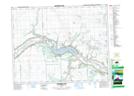
Maps showing Cotham, 12-19-5-W2, Saskatchewan
Cotham is a Unincorporated area located in 12-19-5-W2, Saskatchewan and has an elevation of 549 meters.
- Latitude: 50° 37' North (decimal: 50.6166751)
- Longitude: 102° 35' West (decimal: -102.5838306)
- Topography Feature Category: Unincorporated area
- Geographical Feature: Locality
- Canadian Province/Territory: Saskatchewan
- Elevation: 549 meters
- Location: 12-19-5-W2
- Atlas of Canada Locator Map: Cotham
- GPS Coordinate Locator Map: Cotham Lat/Long
Cotham NTS Map Sheets