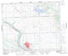
Maps showing Craigavon, 19-46-14-W3, Saskatchewan
Craigavon is a Unincorporated area located in 19-46-14-W3, Saskatchewan.
- Latitude: 52° 59' North (decimal: 52.9834040)
- Longitude: 108° 1' West (decimal: -108.0173181)
- Topography Feature Category: Unincorporated area
- Geographical Feature: Railway Point
- Canadian Province/Territory: Saskatchewan
- Location: 19-46-14-W3
- Atlas of Canada Locator Map: Craigavon
- GPS Coordinate Locator Map: Craigavon Lat/Long
Craigavon NTS Map Sheets