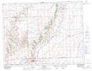
Maps showing Crawford Coulee, 21,22,28-7-21-W3, Saskatchewan
Crawford Coulee is a Valley located in 21,22,28-7-21-W3, Saskatchewan and has an elevation of 1071 meters.
- Latitude: 49° 35' North (decimal: 49.5833571)
- Longitude: 108° 48' West (decimal: -108.8007167)
- Topography Feature Category: Valley
- Geographical Feature: Coulee
- Canadian Province/Territory: Saskatchewan
- Elevation: 1071 meters
- Location: 21,22,28-7-21-W3
- Atlas of Canada Locator Map: Crawford Coulee
- GPS Coordinate Locator Map: Crawford Coulee Lat/Long
Crawford Coulee NTS Map Sheets