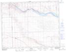
Maps showing Beyers Coulee, 22-23-19-W3, Saskatchewan
Beyers Coulee is a Valley located in 22-23-19-W3, Saskatchewan and has an elevation of 603 meters.
- Latitude: 50° 58' North (decimal: 50.9667142)
- Longitude: 108° 34' West (decimal: -108.5673788)
- Topography Feature Category: Valley
- Geographical Feature: Coulee
- Canadian Province/Territory: Saskatchewan
- Elevation: 603 meters
- Location: 22-23-19-W3
- Atlas of Canada Locator Map: Beyers Coulee
- GPS Coordinate Locator Map: Beyers Coulee Lat/Long