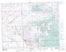
Maps showing Birch Island Lake, 30,31-9-4-W2, Saskatchewan
Birch Island Lake is a Lake located in 30,31-9-4-W2, Saskatchewan and has an elevation of 789 meters.
- Latitude: 49° 46' North (decimal: 49.7666826)
- Longitude: 102° 32' West (decimal: -102.5338234)
- Topography Feature Category: Lake
- Geographical Feature: Lake
- Canadian Province/Territory: Saskatchewan
- Elevation: 789 meters
- Location: 30,31-9-4-W2
- Atlas of Canada Locator Map: Birch Island Lake
- GPS Coordinate Locator Map: Birch Island Lake Lat/Long