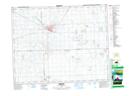
Maps showing Birmingham Junction, 31-22-6-W2, Saskatchewan
Birmingham Junction is a Unincorporated area located in 31-22-6-W2, Saskatchewan and has an elevation of 562 meters.
- Latitude: 50° 56' North (decimal: 50.9333371)
- Longitude: 102° 50' West (decimal: -102.8338294)
- Topography Feature Category: Unincorporated area
- Geographical Feature: Railway Point
- Canadian Province/Territory: Saskatchewan
- Elevation: 562 meters
- Location: 31-22-6-W2
- Atlas of Canada Locator Map: Birmingham Junction
- GPS Coordinate Locator Map: Birmingham Junction Lat/Long