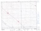
Maps showing Blewett, 12-5-10-W2, Saskatchewan
Blewett is a Unincorporated area located in 12-5-10-W2, Saskatchewan and has an elevation of 582 meters.
- Latitude: 49° 23' North (decimal: 49.3833619)
- Longitude: 103° 14' West (decimal: -103.2338216)
- Topography Feature Category: Unincorporated area
- Geographical Feature: Railway Point
- Canadian Province/Territory: Saskatchewan
- Elevation: 582 meters
- Location: 12-5-10-W2
- Atlas of Canada Locator Map: Blewett
- GPS Coordinate Locator Map: Blewett Lat/Long