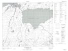
Maps showing Blind Creek, 69-20-W2, Saskatchewan
Blind Creek is a River located in 69-20-W2, Saskatchewan.
- Latitude: 54° 59' North (decimal: 54.9833975)
- Longitude: 104° 56' West (decimal: -104.9337797)
- Topography Feature Category: River
- Geographical Feature: Creek
- Canadian Province/Territory: Saskatchewan
- Location: 69-20-W2
- Atlas of Canada Locator Map: Blind Creek
- GPS Coordinate Locator Map: Blind Creek Lat/Long
Blind Creek NTS Map Sheets