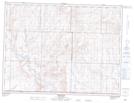
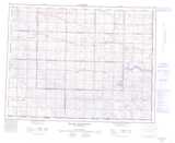
Maps showing Turkeytrack Coulee, 1-10,11-W3, Saskatchewan
Turkeytrack Coulee is a Valley located in 1-10,11-W3, Saskatchewan.
- Latitude: 49° 0' North (decimal: 49.0000227)
- Longitude: 107° 21' West (decimal: -107.3506094)
- Topography Feature Category: Valley
- Geographical Feature: Coulee
- Canadian Province/Territory: Saskatchewan
- Location: 1-10,11-W3
- Atlas of Canada Locator Map: Turkeytrack Coulee
- GPS Coordinate Locator Map: Turkeytrack Coulee Lat/Long
Turkeytrack Coulee NTS Map Sheets