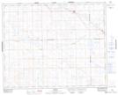
Maps showing Grosswerder, 10-37-27-W3, Saskatchewan
Grosswerder is a Unincorporated area located in 10-37-27-W3, Saskatchewan and has an elevation of 738 meters.
- Latitude: 52° 10' North (decimal: 52.1667345)
- Longitude: 109° 46' West (decimal: -109.7674328)
- Topography Feature Category: Unincorporated area
- Geographical Feature: Locality
- Canadian Province/Territory: Saskatchewan
- Elevation: 738 meters
- Location: 10-37-27-W3
- Atlas of Canada Locator Map: Grosswerder
- GPS Coordinate Locator Map: Grosswerder Lat/Long
Grosswerder NTS Map Sheets