Maps showing Gunnworth, 26-27-16-W3, Saskatchewan
Gunnworth is a Unincorporated area located in 26-27-16-W3, Saskatchewan and has an elevation of 619 meters.
- Latitude: 51° 20' North (decimal: 51.3333827)
- Longitude: 108° 9' West (decimal: -108.1506913)
- Topography Feature Category: Unincorporated area
- Geographical Feature: Railway Point
- Canadian Province/Territory: Saskatchewan
- Elevation: 619 meters
- Location: 26-27-16-W3
- Atlas of Canada Locator Map: Gunnworth
- GPS Coordinate Locator Map: Gunnworth Lat/Long
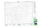
Gunnworth NTS Map Sheets