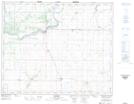
Maps showing Hagen, 3-46A-25-W2, Saskatchewan
Hagen is a Hamlet located in 3-46A-25-W2, Saskatchewan and has an elevation of 480 meters.
- Latitude: 52° 56' 13'' North (decimal: 52.9368917)
- Longitude: 105° 33' 23'' West (decimal: -105.5562667)
- Topography Feature Category: Hamlet
- Geographical Feature: Organized Hamlet
- Canadian Province/Territory: Saskatchewan
- Elevation: 480 meters
- Location: 3-46A-25-W2
- Atlas of Canada Locator Map: Hagen
- GPS Coordinate Locator Map: Hagen Lat/Long