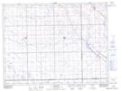
Maps showing Halbrite, 21-6-12-W2, Saskatchewan
Halbrite is a Village located in 21-6-12-W2, Saskatchewan and has an elevation of 580 meters.
- Latitude: 49° 29' 17'' North (decimal: 49.4881832)
- Longitude: 103° 33' 33'' West (decimal: -103.5591749)
- Topography Feature Category: Village
- Geographical Feature: Village
- Canadian Province/Territory: Saskatchewan
- Elevation: 580 meters
- Location: 21-6-12-W2
- Atlas of Canada Locator Map: Halbrite
- GPS Coordinate Locator Map: Halbrite Lat/Long