Maps showing Hallam Creek, 27-38-28-W3, Saskatchewan
Hallam Creek is a River located in 27-38-28-W3, Saskatchewan and has an elevation of 655 meters.
- Latitude: 52° 18' North (decimal: 52.3000701)
- Longitude: 109° 55' West (decimal: -109.9174372)
- Topography Feature Category: River
- Geographical Feature: Creek
- Canadian Province/Territory: Saskatchewan
- Elevation: 655 meters
- Location: 27-38-28-W3
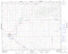
- Atlas of Canada Locator Map: Hallam Creek
- GPS Coordinate Locator Map: Hallam Creek Lat/Long
Hallam Creek NTS Map Sheets