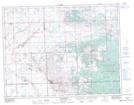
Maps showing Handsworth, 25-10-8-W2, Saskatchewan
Handsworth is a Unincorporated area located in 25-10-8-W2, Saskatchewan and has an elevation of 632 meters.
- Latitude: 49° 51' North (decimal: 49.8500187)
- Longitude: 102° 57' West (decimal: -102.9505052)
- Topography Feature Category: Unincorporated area
- Geographical Feature: Hamlet
- Canadian Province/Territory: Saskatchewan
- Elevation: 632 meters
- Location: 25-10-8-W2
- Atlas of Canada Locator Map: Handsworth
- GPS Coordinate Locator Map: Handsworth Lat/Long